
The Project Gutenberg EBook of Shoshone National Forest, Wyoming, by
U. S. Forest Service

This eBook is for the use of anyone anywhere in the United States and
most other parts of the world at no cost and with almost no restrictions
whatsoever.  You may copy it, give it away or re-use it under the terms
of the Project Gutenberg License included with this eBook or online at
www.gutenberg.org.  If you are not located in the United States, you'll
have to check the laws of the country where you are located before using
this ebook.


Title: Shoshone National Forest, Wyoming

Author: U. S. Forest Service

Release Date: June 11, 2019 [EBook #59736]

Language: English

Character set encoding: UTF-8

*** START OF THIS PROJECT GUTENBERG EBOOK SHOSHONE NATIONAL FOREST, WYOMING ***


Produced by Stephen Hutcheson and the Online Distributed
Proofreading Team at http://www.pgdp.net

F-308571
ON THE COVER
Index Peak from the Red
Lodge-Cooke City Highway.
Few mountainous sections
are more rugged or
spectacular than the Absarokas
of the Shoshone.
UNITED STATES DEPARTMENT OF AGRICULTURE
FOREST SERVICE
Rocky Mountain Region · Denver, Colorado
UNITED STATES
GOVERNMENT PRINTING OFFICE
WASHINGTON: 1941
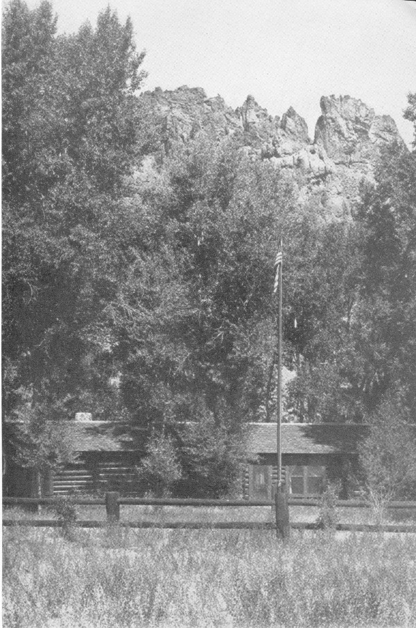
F-385973
Wapiti Ranger Station—the oldest in existence.
A map of the Shoshone National Forest, with details including roads and points of interest, will be found on the inside of the back cover.
The Shoshone National Forest was set aside by proclamation of President Benjamin Harrison as the Yellowstone Park Timberland Reserve on March 30, 1891. It was the first unit of its kind created after the passage of the Act of March 3, 1891, authorizing the establishment of forest reserves—as national forests were then called—to protect the remaining timber on the public domain from destruction and to insure a regular flow of water in the streams. On the fiftieth anniversary of the establishment of the Shoshone, the national forests embrace approximately 176,000,000 acres of forest land, located in 36 States, Alaska, and Puerto Rico.
The Shoshone National Forest is situated in the heart of the Absaroka Mountains, in northwestern Wyoming. It is bounded on the north by the Montana-Wyoming State line, on the east by the Big Horn Basin, on the south by the Washakie and Teton Forests, and on the west by the Yellowstone National Park. It lies almost entirely within Park County; minor portions extend into Hot Springs and Fremont Counties.
This national forest is the largest of 21 in the Central Rocky Mountain Region, including within its boundaries 1,592,428 acres, of which all but 26,104 are Federal land. The forest is about 75,000 acres larger than the State of Delaware. Elevations within the forest range from 4,600 to 13,140 feet, thus providing a wide variation in climate, vegetation, and wildlife. At the lower elevations the summers are warm and the winters mild. The higher mountains enjoy only a brief cool summer and are snowclad most of the year.
Few mountainous sections are more rugged or spectacular. Geologically the formations are new, and immense areas of exposed rock are broken by and interspersed with mountain meadows and mantles of unbroken forests. Those who have packed into the back country, or have driven through the North Fork of the Shoshone River Canyon, or over the Beartooth Plateau agree that the variety of scenery and vegetative types is superlative.
In the administration of national forests the aim is to manage them in such a way as to make their resources of largest service to the local communities, the State, and the Nation. This is accomplished by promoting 2 the highest social and economic uses of the forests consistent with the proper use of lands. Such an objective is definitely pointed toward the maximum sustained yield from all resources.
The national forests are under the administration of the Forest Service, U. S. Department of Agriculture. Each forest is under the charge of a forest supervisor. Headquarters of the Shoshone is in Cody, Wyo. Every forest is divided into districts, each of which is under the supervision of a district ranger, who has control of all its activities. His responsibilities include protection of the resources against fire and other enemies, the supervision of timber sales, and the grazing of large numbers of cattle, sheep, and horses; the management of wildlife resources; looking after different permitted uses, such as pastures, summer homes, resorts, power developments; maintaining forest improvements, including ranger station buildings, lookout stations, telephone lines, roads, trails, and range improvements; and providing protection and furnishing information to the thousands of people who come every year to enjoy vacations in the forest.
The Shoshone National Forest is divided into four ranger districts, as follows: The Clarks Fork, the Wapiti, the South Fork, and Greybull. The Greybull is the smallest ranger district, with approximately 300,000 acres. The Clarks Fork is the largest, with about 529,000 acres under the jurisdiction of the district ranger.
Perhaps nothing contributes more to the real enjoyment and to the fascination of a forest than a knowledge of its early history. Many events within this area played an important part in the growth and development of northwestern Wyoming. Many of these are nearly forgotten, and others are not generally known.
The earliest inhabitants of the forest are believed to have been Indians known as the “Sheepeaters.” Just who the “Sheepeaters” were is not definitely known. Some historians claim they were an unintellectual branch of the Snake tribe, others insist that they were renegades and misfits, driven out of the plains tribes, the Crows, Blackfeet, and Shoshones, who were forced to the timberclad hills where rough topography and cover permitted them to evade capture and killing at the hands of their erstwhile tribal members. They lived in crude tepees constructed entirely of poles. The “Sheepeaters” derived their name from the fact that they preyed extensively on mountain sheep and to some extent on other species of big game. They trapped their prey in pens or corrals made of stone.
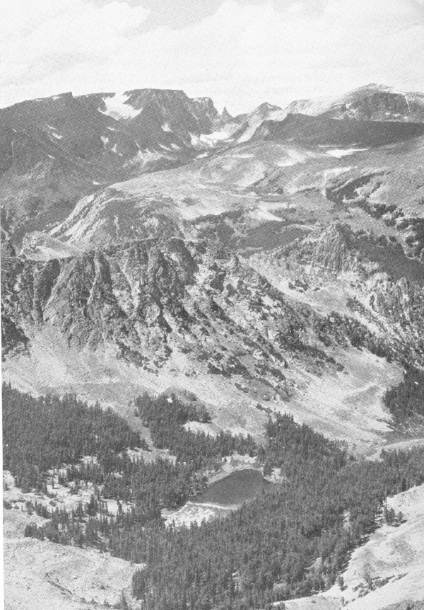
F-308547
A section of the rugged Beartooth Plateau as seen from the Red Lodge-Cooke City Highway.
The first white men entered Wyoming more than 30 years before the American Revolution. In 1743, Francois and Louis De La Verendrye, French-Canadian brothers, traveled through the Rocky Mountain region to establish branch trading posts. Their home and main post was in the Great Lakes region. They entered the Big Horn Valley from the north and traveled up Wood River in the southern part of the forest and crossed the rugged Continental Divide near the Washakie Needles on their way into the Wind River country.
Years later, in 1807, John Colter, who startled the world with his fantastic and unbelievable stories of the natural wonders in Yellowstone Park, traveled up the Clarks Fork River, after leaving the Lewis and Clark Expedition on the Missouri. Colter’s exact routes of travel are hotly disputed by historians, but it is well established that he was the first white man to see the “Stinking Water” River (the Shoshone), so named by him because of the foul odors from mineral hot springs along its banks.
The trail along the Clarks Fork followed by Colter was for generations a transmountain route of Indian tribes living west of the Continental Divide which led to the great buffalo country to the east. Among the tribes using this trail were the Bannocks and Lemhi. After hunting among the herds in the Big Horn Basin and on the plains east of the Big Horn Mountains, they returned to their homes heavily laden with meat and hides. These expeditions frequently led to fiercely fought battles with the Shoshones and Crows, whose territories were being invaded.
The De La Verendryes and Colter were followed by other “mountain men,” equally venturesome, representing the American and Rocky Mountain fur companies and smaller independent concerns. These hardy, restless, rugged individuals, including such men as Lisa, Sublette Brothers, Fraeb, Gervais, and Bridger, were actually the first settlers in what is now the State of Wyoming, notwithstanding the common belief that the first settlements in the Territory were in the eastern and southern parts. These pioneers exploited the country, trapping fur-bearing animals and trading with the Indians for their take in the pelts.
Following them came the nomadic prospectors and miners, and after the miners came the first really permanent residents, the cattlemen. The establishment of the first Stockyards in Kansas City, in 1870, gave impetus to the expansion of cattle-raising in the West. From 1870 to the 1890’s, this industry grew with unprecedented speed. Charles Carter, in 1879, trailed in from Oregon the first herd of cattle brought into the Big Horn Basin. Later came Capt. Henry Belknap, Otto Franc, Col. W. D. Pickett, and J. M. Carey, all of whom shaped ranches out of virgin territory on the west side of the Big Horn Basin, immediately adjacent to the mountain slopes now inside the forest.
From the early eighties the herds increased, and more and more cattle 5 came into the Big Horn Basin. Homesteaders and settlers were “squatting” on and taking up large acreages of the best range land, and finally, there was not enough year-long range for the increased number of livestock. The advent of the farmer forced drastic changes in livestock operations. Stockmen were obliged to produce forage crops to carry a part of their herds through the winter. Eventually it was necessary to increase the production of forage crops on the land under cultivation, and this led to the development of irrigation projects, first by the ranchers, and then by the Federal Government. With water for their lands and constantly improving transportation facilities, farmers were able to produce such cash crops as small grain, truck crops, sugar beets, potatoes, and peas.
As this country was further developed and became more heavily populated, stockmen grazed their livestock in the higher foothills and eventually in the mountains during summer, depending upon the Big Horn Basin, which had formerly been used year-long, for winter range. Thus began the first actual dependence of the community upon territory within the forest. As irrigation projects developed, the second—and now perhaps the most important—great economic value of the rugged mountains in the forest became apparent in their capacity to conserve and store water for summer use in the valleys below.
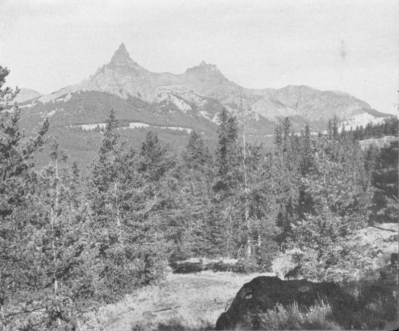
F-385841
Pilot and Index Peaks, within the North Absaroka Wilderness Area.
The Federal Government recognized the importance of placing the great mountain wilderness of the West under control, to assure the perpetuity and proper use of the natural resources. The establishment of the Shoshone 6 Forest in 1891 was the first step taken in carrying out this comprehensive program. The preservation of the natural resources is now assured, not by the elimination of use of the forage, timber, water, and other resources of the forest, but rather by the use of all under proper and progressive management.
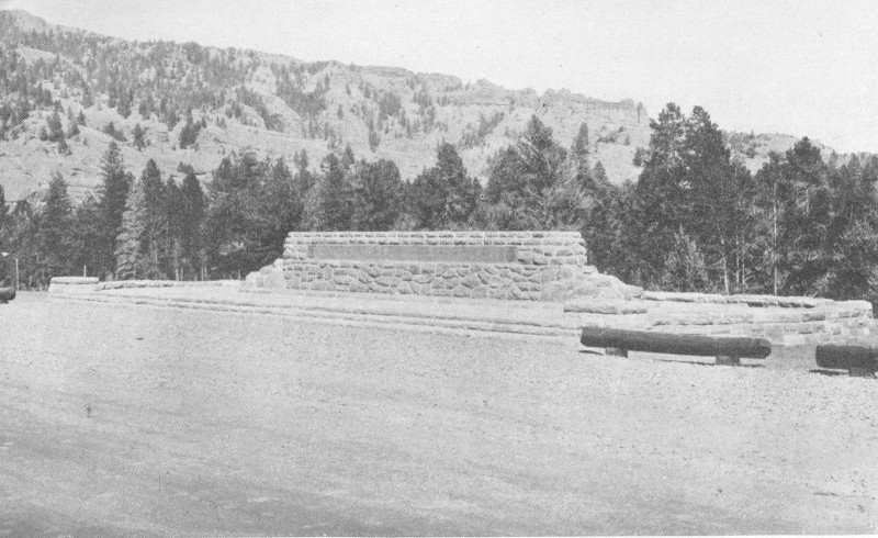
F-386010
The Blackwater Firefighters Memorial.
Bliss Creek.—One of the favorite routes of rustlers in earlier days, leading to their favorite rendezvous in Jackson Hole, followed Clark Creek at the head of the South Fork of the Shoshone River. In 1892, a horse thief named Bliss, attempting to escape pursuers, was captured by a posse after a long and grueling chase. He was shot and buried at a point about a mile above Clark Creek, near where a small stream from the north empties into the South Fork. This stream was named Bliss Creek as a result of this episode. Bliss’s grave was marked by a rude pile of stones along the trail until a very few years ago when it was destroyed by a mountain cloudburst. Bliss Creek can be reached only with a saddle horse and is 35 miles southwest of Valley.
Beartooth Plateau.—After two military expeditions had previously failed, the first official crossing of Beartooth Plateau was accomplished during the last week of August 1882 by a scouting party headed by Lt. Gen. P. H. Sheridan. In his party were 71 officers, soldiers, and civilians, 36 packers, 1 hunter, and 5 Shoshone Indian scouts and 1 Squaw. The party reached Cooke City, Mont., on August 24 from Mammoth Hot Springs, and Billings on August 31. The route selected and followed by General Sheridan was 7 almost identical with that of the present Red Lodge-Cooke City Highway.
Dead Indian Hill.—A small war party of Bannocks was attacked by General Miles’ troops just south of Clark, near the northeast corner of the forest, in 1878, shortly after the Nez Perce outbreak. The Indians retreated over what is now known as Dead Indian Hill, about 16 miles southwest of Clark, leaving one of their wounded behind. The following day the Bannock was found by some of the Crow Indian Army scouts, who promptly killed and scalped him. Until recent years a rude pile of stones halfway down the west side of the hill, north of the road and near the drift fence, marked the grave. From this episode the hill got its name. Captain Bennett, in charge of the cavalry troop which engaged the Bannocks, and one of his Crow scouts, Little Rock, lost their lives in the fight. Two streams running down the east face of Beartooth Plateau, just west of Clark, bear the names of these men.
Camp Monaco.—Located about 15 miles north of Pahaska Tepee, along the North Fork of the Shoshone River, is one of the old hunting camps of Colonel Cody, Camp Monaco. Here in September 1913, Colonel Cody took as his guests on a hunting trip, Albert I, Prince of Monaco, and his aide-de-camp, Count Beret. At the close of the successful hunt, the Prince had his artist paint on a large tree at the camp site, “Camp Monaco, 1913,” and a bear’s foot.
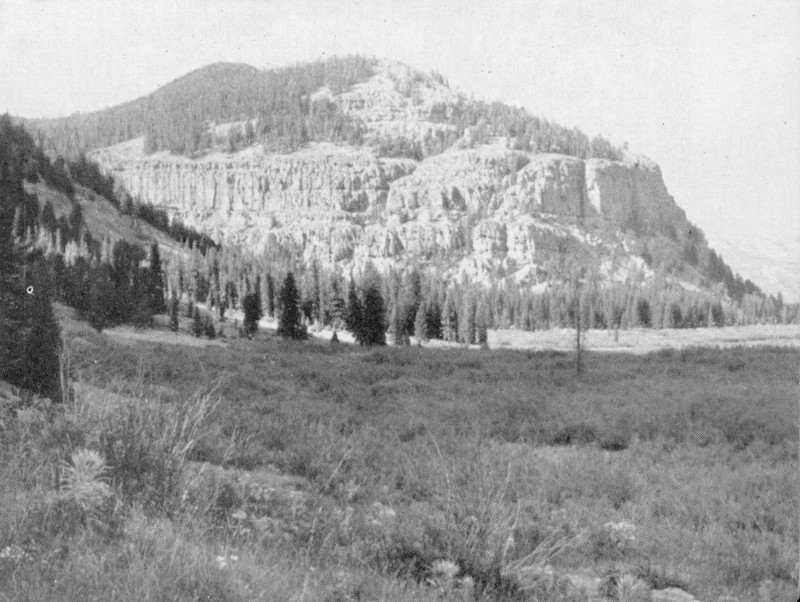
F-385957
Bliss Creek Meadows on Upper South Fork—within the South Absaroka Wilderness Area.
Frank Hammitt Grave.—Frank Hammitt was one of the first six forest rangers appointed in the United States. He met his death by plunging over the precipitous walls of Russell Creek Canyon near its mouth, on 8 July 25, 1903. His grave is near the south base of Antelope Mountain, beside the Crandall Road. Hammitt was trained for the priesthood, but gave it up for the life of a cowboy. For 7 years he was chief of cowboys with Colonel Cody’s Wild West Show before he became a forest ranger.
Jack Crandall Grave.—On July 1, 1870, a prospector named Jack Crandall and his partner, T. Dougherty, were on their way to a rendezvous with some miner friends on the headwaters of the Clarks Fork River. The two men made camp on Crandall Creek and, as they prepared their evening meal, were killed by a marauding band of Indians. The miners’ picks were driven into the ground and their severed heads were spitted on the ends protruding. The grave of these men is marked by a huge boulder on which is a large bronze plate giving a brief history of the incident. It is located on the north side of Crandall Creek, about three-fourths of a mile upstream from the Crandall Creek bridge, on the Sunlight-Clarks Fork Road.
Pahaska Tepee.—Pahaska Tepee, situated alongside the Cody-Yellowstone Highway, 51 miles west of Cody, is the original hunting lodge of Colonel Cody, which he built in 1901. Here he entertained such distinguished guests as Albert I, Prince of Monaco, statesmen, and the more famous members of his troup.
Sheepeaters’ Tepees.—Ancient tepees of the “Sheepeaters” made entirely of poles are to be found in different parts of the forest. There is a group of three, well preserved, on Tepee Creek, a tributary of the North Fork of Crandall Creek, where the trail crosses. Another is located about 1 mile above the Timber Creek Ranger Station, along an old logging road. They can be reached only with saddle horses.
The Old Stockade.—In August of 1891, a cowboy discovered a log stockade on Beartooth Plateau, on the divide between Little Rock and Bennett Creeks, about 3 miles north of Deep Lake. The stockade, resembling a corral about 50 feet in diameter, had been made of huge logs laid up similarly to those in a log house. Here and there along the walls loopholes had been cut, obviously to permit shooting through them. The stockade was old when found. Who it was built by and why is not known. The logs had been cut with a sort of an ax or a hatchet, yet only a portion of the work appeared to be that of white men. Some of the chopping appeared to have been done by a man familiar with the use of an ax, while other logs were literally “gnawed off.” The old stockade is still standing. It can be reached only afoot or with horses.
Wapiti Ranger Station.—The Wapiti Ranger Station, situated along the Cody-Yellowstone Highway, 30 miles west of Cody, is the oldest ranger station in the United States built with Government funds. It was erected in 1901.
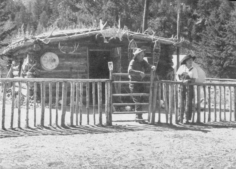
F-385979
A typical trappers’ cabin on the South Fork.
The Firefighters Memorial.—On August 21, 1937, 15 men lost their lives in what is known as the Blackwater Fire. Along the Cody-Yellowstone Highway, 36 miles west of Cody, at the mouth of Blackwater Creek, a large cut stone monument has been constructed by the Forest Service and the Civilian Conservation Corps, to commemorate the memory of these men. The fire, which originated 4 miles south of the memorial, burned over 1,254 acres. The Memorial Trail, a splendid foot or horse trail, begins at the Firefighters Monument and leads to the burned-over area and to Clayton Gulch, located 6 miles south, where a stone marker with a huge bronze placque has been constructed to mark the site where Ranger Alfred G. Clayton, Foreman James T. Saban, Assistant to Technician Rex Hale, and four Civilian Conservation Corps enrollees—Rodgers, Gerdes, Griffith, and Mayabb—were burned to death. In addition, Junior Forester Paul E. Tyrrel, Billy Lea, a workman on a Bureau of Public Roads crew, and CCC enrollees Allen, Garaza, Bevens, Seelke, Sherry, and Whitlock died as a result of burns suffered on this fire.
Upon the recommendation of the Forest Service, the United States Board of Geographic Names has changed the name of Double Mountain, which is the highest point in the vicinity of the Blackwater area, to Clayton Mountain, in honor of Ranger Clayton. A lookout tower is being constructed on Clayton Mountain, which commands a view of a considerable area of the Shoshone National Forest.
Timber Resources.—The actual forested areas within the Shoshone extend in altitudinal range from about 6,000 to 10,000 feet above sea level. Below the lower limits of the typical forest areas is a scattering tree growth of aspen and cottonwoods, restricted principally to the stream courses.
It is estimated that approximately 48 percent of the net area of the forest is covered with timber, and supports a stand of some 2¼ billion board feet. Lodgepole pine, Douglas fir, and Engelmann spruce are the principal timber species; alpine fir, Rocky Mountain red cedar, and several minor broadleaved species also occur.
Mature timber may be purchased, and when sales are made the cut is so regulated that a perpetual supply of timber will be available without destroying the forest cover. There are more than 20 different timber operations within the forest which provide lumber, posts, poles, and other timber products for the communities and residents of the Big Horn Basin and adjacent territory, and provide a living for approximately 100 families. These operations also supply such special products as railroad ties and mine timbers and props. Hundreds of ranchers and farmers obtain directly such material as corral poles, fence posts, and fuel from the forest.
Water Resources.—The vast coniferous forests of the Shoshone are important as a ground cover in regulating the flow of streams having their headwaters inside its boundaries. By retarding the run-off from melting snows and rains, the forests help to prevent erosion and floods in the spring and conserve the flow of water through the summer when it can be used for irrigation. The development of agriculture and, in fact, the future growth of Wyoming and other Western States are absolutely dependent upon irrigation water. Two large irrigation projects, the Shoshone and Sunshine, are dependent upon the forest watersheds, as are many cooperative and individual users. Without doubt the greatest social and economic contribution of the forest to those living within and adjacent to it, and the State at large, is water for irrigation and domestic use.
The Shoshone project waters 73,000 acres, on which agricultural crops having a value of approximately $2,000,000 are raised annually. With the completion of the Hart Mountain Division of this project, the area under water will be increased by approximately 41,000 acres. Local enterprise in the form of cooperative and individual projects has brought under irrigation more than 60,000 acres additional. The Sunshine project provides supplemental water for a part of the land included in the last figure given. If the Shoshone project is developed to capacity, it is estimated that approximately 163,000 acres of land will be under water.
There are over a million acres of arid lands in the plains of the Big Horn and Yellowstone Basins, with favorable soils and potential farm values if 11 water can be made available for irrigation. It is important to conserve the forest and forage cover so that the greatest volume of usable water may be available for agricultural use. The future prosperity and agricultural development of the region is limited to a great extent by the amount of water that can be supplied for irrigation from the streams having their sources within the Shoshone Forest.
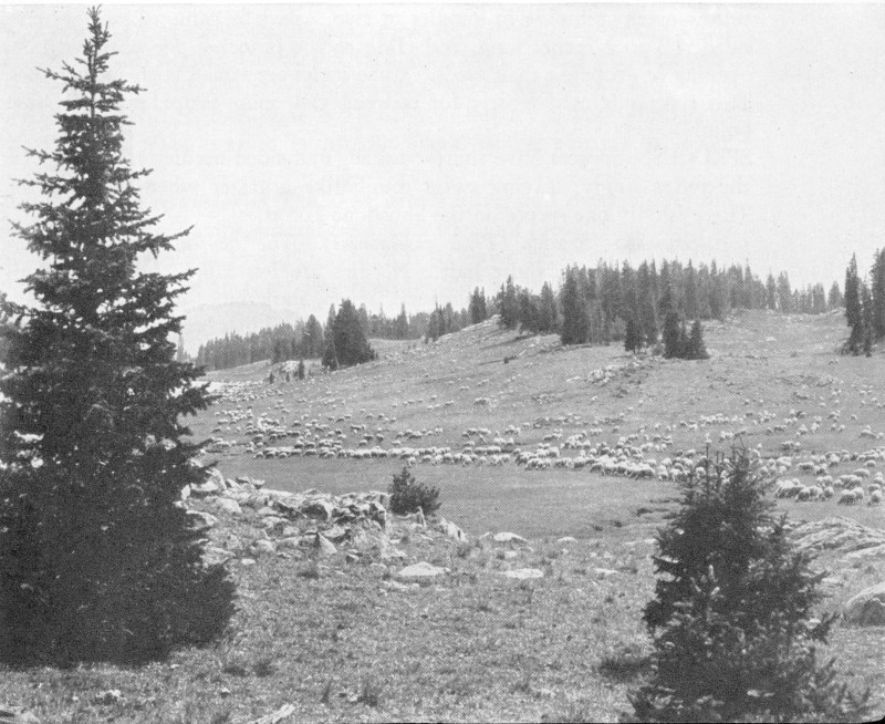
Grazing Resources.—The raising of livestock is a basic industry in Wyoming. The Shoshone provides summer range for 10,000 cattle and horses, and 75,000 sheep, owned by almost 200 resident owners. The higher ranges are particularly good for the production of lambs and wool, and the lower ones are excellent for beef. Range is also furnished for horse herds of the dude ranchers and for dairy cattle.
Permittees grazing livestock in the national forest are assigned specific grazing allotments, and are required to handle their stock according to approved management practices. Local officers endeavor to stock all ranges conservatively for the purpose of preventing range deterioration which reduces the volume of forage produced and starts erosion.
Grazing permittees are selected on the basis of ownership of improved ranch property which is dependent upon forest range to make it an economic unit. This policy favors the established tax-paying citizen and eliminates the tramp stockman who has no base of operations but exploits the country through which he passes.
In spite of the fact that all ranges adapted to the grazing of livestock have been fully stocked for many years, sufficient forage is reserved to take care of the 3,500 elk, 6,200 mule deer, 750 antelope, 700 mountain sheep, and 250 moose which inhabit the forest.
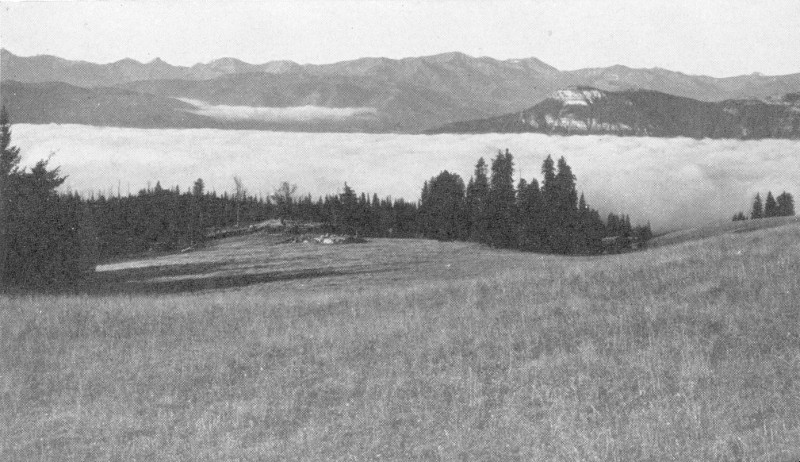
F-385820
High above the clouds on Beartooth Plateau.
No single activity of the forest has grown so rapidly in recent years as recreation. The forest is ideally adapted to recreational use because of the rough, majestic, and undeveloped character of its wilderness where most travel must be done with a horse and pack outfit. It is truly a forest with a “back country.” The numerous lakes and mountain streams, the glaciers, the vast forest cover, and the abundance of fish and game are attractions that draw large numbers of people who wish to see wilderness areas unspoiled by the hand of man.
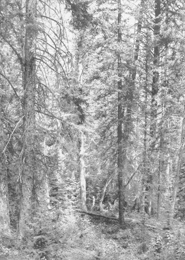
F-385837
Mixed virgin stand of Engelmann spruce and Douglas fir.
Wilderness Areas.—Two wilderness areas—the North Absaroka, containing about 380,000 acres, and the South Absaroka, containing about 600,000 acres—have been set aside to insure the perpetuation of the delightful natural and virgin conditions characteristic of the back country in the Shoshone. Entirely undeveloped, except for horse trails and occasional sanitation facilities at camp sites, primeval conditions are comparable to those encountered when John Colter traveled through this country in the early years of the nineteenth century. No roads will be permitted nor will there be any hotels, resorts, or summer homes. Sales of timber will not be made, but the grazing of domestic stock—cattle, horses, and sheep—will be allowed under well-regulated conditions, insuring ample range for big game animals and the protection of the basic soil and water resources.
These wilderness areas and the wildlife and fishing resources of the forest are the basis for one of northwestern Wyoming’s principal industries—dude ranching. Within and adjacent to the Shoshone are more than 30 such ranches and similar resorts. Guests enjoy all of the sports common in the mountains—fishing, hunting, hiking, or riding delightful trails. As the cool of the evening descends, they enjoy sitting before a glowing campfire to hear yarns of the West. These ranches and resorts have various types of accommodations for overnight or weekend guests, camping parties, pack trips, or family groups. Hundreds of guests visit them annually, and go home with tanned faces and a spring in their step.
Within the forest are two main highways which offer splendid scenery to those who do not have the time or inclination to get into the back country with horses and pack outfits.
Along the North Fork.—The Cody Road to the Yellowstone National Park, U. S. 20, winds its way along the banks of the North Fork of the Shoshone River. The forest boundary is 25 miles west of Cody, and on the way, such interesting features as DeMaris Hot Springs, extinct geyser cones and craters, the Shoshone Dam, the tunnels, the Shoshone Cavern National Monument, and typical western stock and dude ranches and resorts can be visited. At the boundary the character of the country changes. The canyon becomes narrower, and here on either side, Signal Peak and Flag Peak, like the Pillars of Hercules, guard the entrance. From this point to the east entrance of Yellowstone Park, the distance is 27 miles.
Within the forest, the road passes through livestock and game ranges, heavily timbered watersheds, with active timber sales in progress, and extensively used recreation areas. Thus the tourist is given an opportunity to actually see the coordinated activities of a national forest. Watch for the Laughing Pig, the Camel, the Holy City, the Goose, the Anvil, Henry Ford, Chimney Rock, the Elephant Head, and other figures carved from rock by the hand of nature.
Along the way there are a number of dude ranches and resorts where accommodations may be had, also gasoline stations and stores. At frequent intervals there are picnic and campgrounds for the use of tourists. These are:
| Name | Miles from Cody | Miles from Yellowstone |
|---|---|---|
| Hanging Rock Campground | 26.8 | 26.2 |
| Horse Creek Campground—Trailers | 28.1 | 24.9 |
| Big Game Campground | 29.1 | 23.9 |
| Wapiti Camp and Picnic Ground | 30.1 | 22.9 |
| Elk Fork Campground | 30.1 | 22.9 |
| Rex Hale Campground | 36.7 | 16.0 |
| Newton Creek Campground—Trailers | 37.5 | 15.5 |
| Eagle Creek Campground | 45.5 | 7.5 |
| Sleeping Giant Campground | 48.9 | 4.1 |
| Three Mile Campground | 49.7 | 3.3 |
| Pahaska Campground—Trailers | 51.0 | 2.0 |
Individual camping stalls, tables, water, and campfire grates are available at all campgrounds.
Beartooth Plateau—Clarks Fork Country.—The Red Lodge-Cooke City Highway, a hard-surfaced road, passes through the most spectacular area in the forest. Leaving Red Lodge, Mont., it follows a southwesterly course along Rock Creek into the Custer National Forest.
Abruptly the highway leaves the creek and turns up the north slope of Beartooth Plateau, and over easy grades zigzags its sinuous way into Wyoming and the Shoshone National Forest and to the very “top of the world.” Once on top a breath-taking panorama unexpectedly unfolds before the astonished traveler. Vision is practically unrestricted in any direction because the road is well above timberline. To the east lies the Big Horn Basin, with the Big Horn Mountains in the background; to the south is the Clarks Fork Valley, Sunlight Basin, and still further south the North Fork and South Fork valleys of the Shoshone. As far as one can see, rugged snowcapped mountains pierce the sky. In the west, Pilot Peak and its Siamese twin, Index Peak, point the way into the heavens. To the north is a continuation of Beartooth Plateau into the Custer Forest which contains grasshopper glaciers and the “land of the red snows.” Everywhere evidences of glaciation and tremendous expanses of barren rock are to be seen. Snowbanks are common. Numerous lakes of various sizes nestle in the pockets of the land. Gradually, as the traveler goes westward, he descends to timberline, where gnarled, stunted trees carry on an age-old struggle for existence against the fierce elements of cold driving snows and terrific winds. Further westward as altitude is lost the timber becomes taller, until as one nears the Clarks Fork River dense, thrifty stands are the rule.
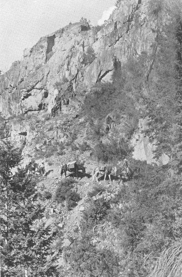
F-385960
A pack string on the South Fork Trail.
Aside from two dude ranches along the road, the only other accommodations within the forest are at Beartooth Lake. Here also are a store, filling station, and picture studio.
The Shoshone National Forest campgrounds along this road are:
| Name | Miles from Cooke City | Miles from Red Lodge |
|---|---|---|
| Crazy Creek Campground | 10.8 | 54 |
| Beartooth Lake Campground | 22.9 | 41.9 |
| Island Lake Campground | 26.0 | 38.8 |
Sunlight Basin.—There is also a third road, unimproved, which in good weather affords a real treat to the auto tourist. It leads from Cody over Dead Indian Hill into Sunlight Basin and the upper Clarks Fork Valley. This road is delightfully scenic and connects with the Red Lodge-Cooke City Highway just below the Nordquist ranch. There are two campgrounds along this route, one where the road crosses Dead Indian Creek and the other at the Sunlight Creek crossing. The road leads to excellent fishing in Dead Indian Creek, Sunlight Creek, the Clarks Fork River, and the waters on Beartooth Plateau. It is the shortest route to Beartooth Plateau from Cody.
Big Game.—The Shoshone is the only forest in Wyoming in which all species of big game native to the State are found, with the exception of the whitetail deer. These include antelope, mule deer, elk, mountain sheep, moose, and black and grizzly bear. What may be even more surprising is that there are open seasons on all species—deer, elk, and bear under the regular license; antelope, mountain sheep, and moose under special permit. Another unusual feature about hunting on the Shoshone is that except for the southern part of the forest the regular hunting season is 60 days long, from September 15 to November 15. In addition, there is a spring bear season from May 1 to June 15, just after the bears come out of hibernation and their skins are best. State Game and Fish regulations frequently change from year to year. If you plan to go hunting, post yourself on the current regulations.
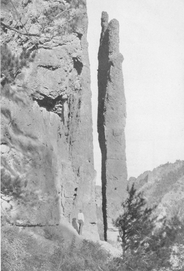
F-385967
Chimney Rock—along the Cody-Yellowstone Highway.
The Shoshone is a favorite rendezvous for nonresident hunters because it has the game, and the outfitters and guides. The State laws require that all nonresident big game hunters hire licensed outfitters and guides to conduct them.
The Forest Service is deeply concerned with the propagation and protection of game. This involves not only cooperating with State officers and enforcing the game laws, but providing game herds with sufficient and suitable range. Throughout the West the national forests supply most of the summer range for big game animals except antelope. The Shoshone Forest is no exception. Most national forests contain sufficient summer range for present game herds and some increases. However, the situation regarding winter range is different. Most of the land at the lower elevations where the game originally wintered is outside the forest. Much of it has been homesteaded and is in livestock ranches and farms. In many sections of the West game, especially deer and elk, are faced with the desperate choice of raiding ranches in the valleys and foothills or starving in the snowdrifts of the high mountains. In some instances the Forest Service has been able to provide winter game range by regulating grazing or eliminating livestock entirely from the ranges. Such an example can be found on the Shoshone on the Elk Fork, Sweetwater, Horse Creek, and Grizzly Creek drainages. This area furnishes winter range for the largest elk herd on the forest, and is reserved especially for it. In addition, several hundred deer also use this same range.
SANITATION AND HEALTH
1. Mountain streams will not purify themselves in a few hundred feet. Boil or chlorinate all suspected water.
2. Burn all paper, old clothing, or rubbish. Bury or place in pits or receptacles provided all garbage, tin cans, bottles, and other refuse.
3. Do not wash soiled clothing or utensils or bathe in springs, streams, or lakes. Use a container and throw dirty water where it cannot get into the water supply without first filtering through the ground.
4. Use the sanitation facilities provided by the Forest Service on campgrounds and elsewhere.
5. Observe the rules of sanitation and protect yourself and others. Report all insanitary conditions to the nearest health or forest officer.
6. Obey the posted “Rules for the use of improved campgrounds.”
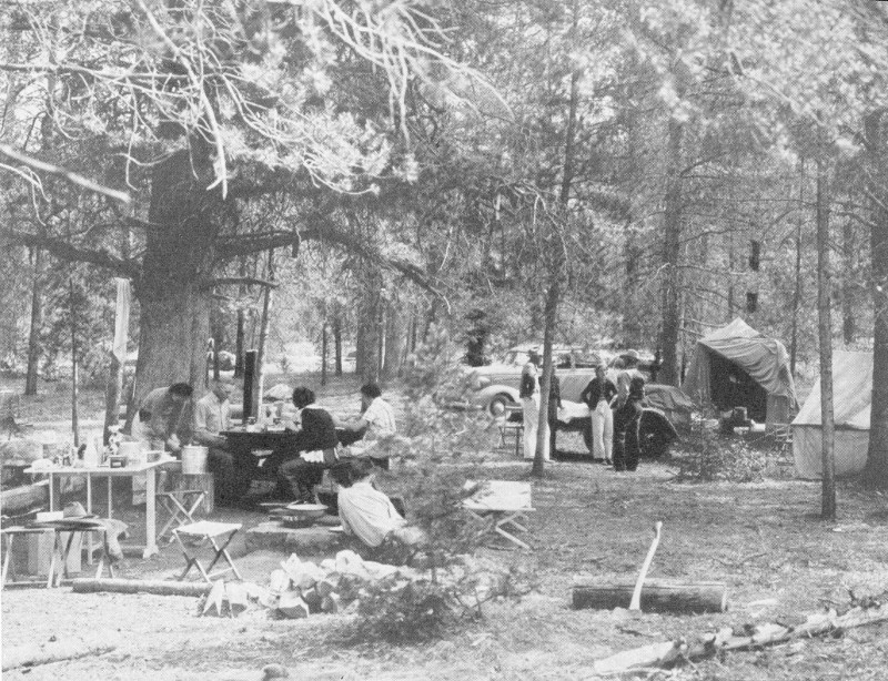
F-386019
A week-end party at one of the forest’s improved campgrounds.
For the purpose of maintaining and preserving the big game herds within them, the State has established the Shoshone and Hoodoo State Game Preserves, where no hunting is permitted.
The Cody-Yellowstone Road passes through the Shoshone Preserve. During the summer months most of the animals, particularly deer, elk, and mountain sheep, are in the high country back from the road. Moose, however, are frequently seen along the river and occasionally deer and bear. During winter and spring, however, hundreds of deer and elk can be seen quietly feeding along the road. Mountain sheep are also frequently seen during these seasons.
Keep your camera loaded when passing through the forest. A shot of a big bull moose or a graceful deer makes just as good a trophy as a head or a hide, and the camera season is always open. It requires much more skill to stalk and shoot game with a camera than with a gun.
If you go hunting be a genuine sportsman by obeying the State laws, by putting out your smokes and campfires, and by leaving a clean camp.
Fur Bearers.—In the old days of the fur brigade and trading posts the area now in the forest furnished its quota of furs, and it still produces some of the finest. The most valuable and most eagerly sought fur bearer is the marten. In addition, there are badger, muskrat, ermine, mink, red fox, coyote, and bobcat. There are also three other species which are protected, beaver, otter, and wolverine, which is extremely rare.
On the Shoshone the trappers are assigned to individual trapping allotments. Each man regards the allotment as his, because it is reissued to him year after year as long as he wishes to hold it and obeys the State and Federal laws. This system promotes harvesting the fur crop rather than mining it. In other words, the trapper realizes that he cannot take all of the animals but must leave a sufficient number to restock the allotment for future trapping. Each trapper is required to report to the proper officer all game law violations occurring within his territory.
Fishing.—Practically all suitable waters of the forest are stocked with fish. Species include the black spotted, rainbow, Eastern brook, and mackinaw trout, Montana grayling, and whitefish.
In recognition of the importance of keeping lakes and streams stocked the State Game and Fish Commission operates a fish hatchery near Cody, and practically all of its output is used in replenishing the waters of the forest. Additional assistance is rendered by the U. S. Bureau of Fisheries by furnishing planting stock from its Yellowstone Park, Crawford, Nebr., and Bozeman, Mont., hatcheries. Forest officers cooperate with representatives of these agencies in planting fish in forest waters. The forest maintains a specially built tank truck for transportation of fish into the mountain waters. Four rearing ponds have been constructed by the Forest Service in which fry and fingerling trout are kept until they are from 4 to 7 inches in length before being released. The percentage of survival of fish reared in such ponds is many times greater than when they are released in turbulent mountain streams before they are large enough to care for themselves.
Each forest fire that burns means a loss of forest resources. Timber, forage, wildlife are destroyed; soil erosion follows; everybody loses. Fires are always a menace in the summertime and more than half of them occur because some careless smoker or camper does not take care of his match, cigarette, pipe, or campfire. From 1909 to the close of 1939, 229 fires, which burned over 25,649 acres, have occurred. In recent years the Shoshone National Forest has suffered heavy losses from two large fires and an increasing number of smaller ones. The Crandall fire in 1935 burned over 12,600 acres. This tremendous and staggering loss was the result of the carelessness of ONE MAN. In 1937, the tragic Blackwater fire occurred. 21 Although only 1,254 acres of forest were destroyed, the fire resulted in one of the worst disasters in the history of the Forest Service fire fighting. Fifteen men, whose memory has been perpetuated in the Firefighters Memorial paid the supreme sacrifice.
New improvements are being constructed in the never-ending fight to prevent or quickly control forest fires. Equipment, such as the Bosworth fire trencher, is being developed. This is a small machine which is guided by an operator and motored by a marine engine. The motor propels a series of steel lugs which kick out dirt and debris and speedily clear a fire trail down to mineral soil. Fire towers, which will make visible a large part of the forest, are in process of construction or are contemplated. In addition to the new tower on Clayton Mountain, another is being erected on Windy Mountain, located about 6 miles south of the Crandall Ranger Station. This will make visible a large portion of this immense country in the North Absaroka wilderness, including the area burned in the Crandall Creek fire of 1935.
F-385833
High ranges produce fat lambs.
Another tower on Clay Butte, near Beartooth Lake, will provide better protection for the scenic Beartooth Plateau and the Clarks Fork Valley.
When a smoke is spotted, the lookout observer determines the bearing to the fire and phones this information to a ranger or the forest supervisor so that action may be taken. If the lookout is uncertain of the stream valley or other topographical feature by which the fire can be located and best reached, a cross shot is obtained from another lookout station, if 22 possible. In case of a large fire, an airplane cruise is sometimes made to observe the progress of the fire and determine the best way of controlling it.
Twenty-five percent of all revenues derived from permitted uses on national forests is returned to the counties for road and school funds. In addition, 10 percent of the forest receipts is returned to the forest for the construction and maintenance of its road and trail system. Actually 35 percent of the gross forest receipts is returned directly and indirectly to the locality from whence it was collected.
PINES.—Pines are conifers distinguished principally by the needles that are gathered together at the base in bundles of from one to five in a little sheath that usually wears off after the first year. The cones have woody scales. There are three pines on the Shoshone.
Limber Pine (Pinus flexilis).—Needles are fine, almost silky, dark green, 1½ to 3 inches long, always in bundles of five. Cones are 3 to 5 inches long, with seeds ⅓ inch long; scales smooth. Bark is light gray or silvery white, except on old trunks, which are blackish brown and furrowed.
Whitebark Pine (Pinus albicaulis).—Very difficult to distinguish from limber pine, although needles are more rigid and slightly curved. Needles are from 1½ to 2½ inches long. Cones are from 1½ to 3 inches long and of a dark purple color. The bark is chalky-white. This tree is found at elevations of from 8,500 to 10,000 feet, or slightly above the limber pine. It is not as important for commercial use as are the other pines.
Lodgepole Pine (Pinus contorta).—Needles are 1½ to 2 inches long, yellow-green, growing in bundles of two. Bark is thin. Cones are one-sided, 1½ to 2 inches long, and cling to the branches for years without opening or dropping their seeds. Cone scales are armed with short spines. This species is used mostly for railroad ties, mine props, and telephone poles.
SPRUCES.—Spruces have sharp-pointed, four-sided needles scattered over the twigs singly, leaving twigs rough like a grater when they fall off. There is only one spruce on the Shoshone Forest.
Engelmann Spruce (Picea engelmanni).—The new-growth twigs are covered with soft, short hair. Needles are less rigid and less sharply pointed than those of blue spruce, green, dark blue, or pale steel-blue. Cones are 1 to 2 inches long. Bark is dark, reddish brown, and separates in the form of small, rounded scales. Main trunk, in contrast to blue spruce, is smooth and clean.
FIRS.—Needles are blunt, flat, and soft to the touch, without any stem where they join branches. They leave flat, round scars when they fall off 23 in contrast to short stubs left by spruce on twigs. Cones, unlike those of other species, stand erect. In the fall, the cones fall to pieces and leave only spikes on the branch. Buds are blunt and pitchy. Blisters, containing liquid pitch or balsam, are scattered over the smooth bark.
Alpine Fir (Abies lasiocarpa).—Leaves are flat, 1 to 1¾ inch long, without any stem where they join the branches. Needles tend to turn upward. Cones are 2½ to 4 inches long, dark purple. The bark is gray and smooth, except in older parts of the tree where it is broken into ridges. Tree has a sharp, spirelike crown. It usually grows mixed with Engelmann spruce.
DOUGLAS FIR (Pseudotsuga taxifolia).—Although similar in name, this species has no direct relationship to the true fir. Its leaves are flat, ¾ to 1½ inches long, with short stems that join them to the branches. Cones are pendent, with three-pronged bracts protruding from the cone scales; they are persistent and fall off the tree whole. Buds are sharp-pointed, shiny, smooth, red brown.
CEDARS.—Rocky Mountain Red Cedar (Juniperus scopulorum).—The berries are about the size of peas, the bark is scaly, the twigs are slender and graceful, and the heartwood is red. The species is distinguished from the one-seed juniper in that its berry usually has two seeds and is bluish or black. The berries mature in 2 years.
BROADLEAF TREES.—Aspen (Populus tremuloides).—Aspens are commonly called “quaking aspens” or “quakers.” The flat, nearly heart-shaped leaves are about 2 inches across; they tremble characteristically in a breeze. The bark is whitish or very pale green, smooth with black scars where branches have dropped off. The trees rarely grow more than 50 feet high.
Narrowleaf Cottonwood (Populus augustifolia).—This is usually a tall tree, 40 to 60 feet high. The bark is dark gray, heavily ridged half or two-thirds of the way up the tree; above that, smooth and pale green. The leaves are ½ inch to 1 inch wide by 2 or 3 inches long, very similar to willow leaves. The species is usually found along streams at lower elevations.
Alder (Alnus tenuifolia).—The alder grows along and overhanging the streams, usually in clumps, several trees from the same root, frequently 4 to 6 inches in diameter and 15 to 25 feet high. Its leaves are large and sharply double toothed. The mature, seed-bearing fruit is conelike and noticeable in winter.
Rocky Mountain Maple (Acer glabrum).—Usually a shrub, but frequently 20 to 30 feet high, this species has paired opposite buds, sharply lobed leaves, light-gray bark, and paired, winged seed. Its leaves are 1 to 2 inches long, opposite each other.
Willows (Salix sp.).—The common shrub of creek bottoms. Leaves are usually narrow and sharp-pointed. Some willows attain a diameter of 4 inches and a height of 15 to 25 feet. The buds are covered by a single scale.
Pacific Serviceberry (Amelanchier florida).—Leaves silvery, sharply toothed toward the end, and alternate on branches. Trees, or more often shrubs, 6 to 15 feet high. Flowers white and in clusters. Five hard seeds in each berry.
Western Chokecherry (Prunus demissa).—This is a shrub, 3 to 15 feet high. Flowers and fruit clustered. Alternate leaves are sharply pointed. Bark, leaves, and seed are bitter. Fruit is black.
RULES FOR FIRE PREVENTION
1. Be sure your match is out. Break it in two before you throw it away.
2. Be sure that pipe ashes and cigar or cigarette stubs are dead before throwing them away. Never throw them into brush, leaves, or needles. Don’t smoke while traveling through the woods.
3. Use fire grates at improved campgrounds and observe the rules for building and extinguishing fires. Before building a campfire at places where no grates are available, scrape away all inflammable material from a place about 4 feet in diameter. Keep your fire small and never build it against trees or logs, or near brush.
4. Never break camp until your fire is out, dead out.
5. Stir the coals while soaking them with water, turn burned sticks and drench both sides. Wet the ground around the fire and be sure the last spark is dead.
6. Never burn slash or brush in windy weather or while there is the slightest danger that the fire will get away.
IF YOU FIND A FOREST FIRE, put it out if you can. If you cannot put it out, report it to the forest supervisor, the ranger, the sheriff, or the nearest telephone operator. Location of the headquarters of the supervisor and the rangers is indicated on the map.
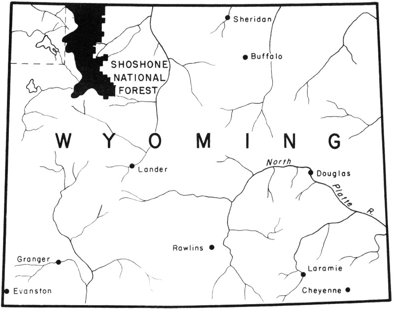
SHOSHONE NATIONAL FOREST
End of the Project Gutenberg EBook of Shoshone National Forest, Wyoming, by
U. S. Forest Service

*** END OF THIS PROJECT GUTENBERG EBOOK SHOSHONE NATIONAL FOREST, WYOMING ***

***** This file should be named 59736-h.htm or 59736-h.zip *****
This and all associated files of various formats will be found in:
        http://www.gutenberg.org/5/9/7/3/59736/

Produced by Stephen Hutcheson and the Online Distributed
Proofreading Team at http://www.pgdp.net


Updated editions will replace the previous one--the old editions will
be renamed.

Creating the works from print editions not protected by U.S. copyright
law means that no one owns a United States copyright in these works,
so the Foundation (and you!) can copy and distribute it in the United
States without permission and without paying copyright
royalties. Special rules, set forth in the General Terms of Use part
of this license, apply to copying and distributing Project
Gutenberg-tm electronic works to protect the PROJECT GUTENBERG-tm
concept and trademark. Project Gutenberg is a registered trademark,
and may not be used if you charge for the eBooks, unless you receive
specific permission. If you do not charge anything for copies of this
eBook, complying with the rules is very easy. You may use this eBook
for nearly any purpose such as creation of derivative works, reports,
performances and research. They may be modified and printed and given
away--you may do practically ANYTHING in the United States with eBooks
not protected by U.S. copyright law. Redistribution is subject to the
trademark license, especially commercial redistribution.

START: FULL LICENSE

THE FULL PROJECT GUTENBERG LICENSE
PLEASE READ THIS BEFORE YOU DISTRIBUTE OR USE THIS WORK

To protect the Project Gutenberg-tm mission of promoting the free
distribution of electronic works, by using or distributing this work
(or any other work associated in any way with the phrase "Project
Gutenberg"), you agree to comply with all the terms of the Full
Project Gutenberg-tm License available with this file or online at
www.gutenberg.org/license.

Section 1. General Terms of Use and Redistributing Project
Gutenberg-tm electronic works

1.A. By reading or using any part of this Project Gutenberg-tm
electronic work, you indicate that you have read, understand, agree to
and accept all the terms of this license and intellectual property
(trademark/copyright) agreement. If you do not agree to abide by all
the terms of this agreement, you must cease using and return or
destroy all copies of Project Gutenberg-tm electronic works in your
possession. If you paid a fee for obtaining a copy of or access to a
Project Gutenberg-tm electronic work and you do not agree to be bound
by the terms of this agreement, you may obtain a refund from the
person or entity to whom you paid the fee as set forth in paragraph
1.E.8.

1.B. "Project Gutenberg" is a registered trademark. It may only be
used on or associated in any way with an electronic work by people who
agree to be bound by the terms of this agreement. There are a few
things that you can do with most Project Gutenberg-tm electronic works
even without complying with the full terms of this agreement. See
paragraph 1.C below. There are a lot of things you can do with Project
Gutenberg-tm electronic works if you follow the terms of this
agreement and help preserve free future access to Project Gutenberg-tm
electronic works. See paragraph 1.E below.

1.C. The Project Gutenberg Literary Archive Foundation ("the
Foundation" or PGLAF), owns a compilation copyright in the collection
of Project Gutenberg-tm electronic works. Nearly all the individual
works in the collection are in the public domain in the United
States. If an individual work is unprotected by copyright law in the
United States and you are located in the United States, we do not
claim a right to prevent you from copying, distributing, performing,
displaying or creating derivative works based on the work as long as
all references to Project Gutenberg are removed. Of course, we hope
that you will support the Project Gutenberg-tm mission of promoting
free access to electronic works by freely sharing Project Gutenberg-tm
works in compliance with the terms of this agreement for keeping the
Project Gutenberg-tm name associated with the work. You can easily
comply with the terms of this agreement by keeping this work in the
same format with its attached full Project Gutenberg-tm License when
you share it without charge with others.

1.D. The copyright laws of the place where you are located also govern
what you can do with this work. Copyright laws in most countries are
in a constant state of change. If you are outside the United States,
check the laws of your country in addition to the terms of this
agreement before downloading, copying, displaying, performing,
distributing or creating derivative works based on this work or any
other Project Gutenberg-tm work. The Foundation makes no
representations concerning the copyright status of any work in any
country outside the United States.

1.E. Unless you have removed all references to Project Gutenberg:

1.E.1. The following sentence, with active links to, or other
immediate access to, the full Project Gutenberg-tm License must appear
prominently whenever any copy of a Project Gutenberg-tm work (any work
on which the phrase "Project Gutenberg" appears, or with which the
phrase "Project Gutenberg" is associated) is accessed, displayed,
performed, viewed, copied or distributed:

  This eBook is for the use of anyone anywhere in the United States and
  most other parts of the world at no cost and with almost no
  restrictions whatsoever. You may copy it, give it away or re-use it
  under the terms of the Project Gutenberg License included with this
  eBook or online at www.gutenberg.org. If you are not located in the
  United States, you'll have to check the laws of the country where you
  are located before using this ebook.

1.E.2. If an individual Project Gutenberg-tm electronic work is
derived from texts not protected by U.S. copyright law (does not
contain a notice indicating that it is posted with permission of the
copyright holder), the work can be copied and distributed to anyone in
the United States without paying any fees or charges. If you are
redistributing or providing access to a work with the phrase "Project
Gutenberg" associated with or appearing on the work, you must comply
either with the requirements of paragraphs 1.E.1 through 1.E.7 or
obtain permission for the use of the work and the Project Gutenberg-tm
trademark as set forth in paragraphs 1.E.8 or 1.E.9.

1.E.3. If an individual Project Gutenberg-tm electronic work is posted
with the permission of the copyright holder, your use and distribution
must comply with both paragraphs 1.E.1 through 1.E.7 and any
additional terms imposed by the copyright holder. Additional terms
will be linked to the Project Gutenberg-tm License for all works
posted with the permission of the copyright holder found at the
beginning of this work.

1.E.4. Do not unlink or detach or remove the full Project Gutenberg-tm
License terms from this work, or any files containing a part of this
work or any other work associated with Project Gutenberg-tm.

1.E.5. Do not copy, display, perform, distribute or redistribute this
electronic work, or any part of this electronic work, without
prominently displaying the sentence set forth in paragraph 1.E.1 with
active links or immediate access to the full terms of the Project
Gutenberg-tm License.

1.E.6. You may convert to and distribute this work in any binary,
compressed, marked up, nonproprietary or proprietary form, including
any word processing or hypertext form. However, if you provide access
to or distribute copies of a Project Gutenberg-tm work in a format
other than "Plain Vanilla ASCII" or other format used in the official
version posted on the official Project Gutenberg-tm web site
(www.gutenberg.org), you must, at no additional cost, fee or expense
to the user, provide a copy, a means of exporting a copy, or a means
of obtaining a copy upon request, of the work in its original "Plain
Vanilla ASCII" or other form. Any alternate format must include the
full Project Gutenberg-tm License as specified in paragraph 1.E.1.

1.E.7. Do not charge a fee for access to, viewing, displaying,
performing, copying or distributing any Project Gutenberg-tm works
unless you comply with paragraph 1.E.8 or 1.E.9.

1.E.8. You may charge a reasonable fee for copies of or providing
access to or distributing Project Gutenberg-tm electronic works
provided that

* You pay a royalty fee of 20% of the gross profits you derive from
  the use of Project Gutenberg-tm works calculated using the method
  you already use to calculate your applicable taxes. The fee is owed
  to the owner of the Project Gutenberg-tm trademark, but he has
  agreed to donate royalties under this paragraph to the Project
  Gutenberg Literary Archive Foundation. Royalty payments must be paid
  within 60 days following each date on which you prepare (or are
  legally required to prepare) your periodic tax returns. Royalty
  payments should be clearly marked as such and sent to the Project
  Gutenberg Literary Archive Foundation at the address specified in
  Section 4, "Information about donations to the Project Gutenberg
  Literary Archive Foundation."

* You provide a full refund of any money paid by a user who notifies
  you in writing (or by e-mail) within 30 days of receipt that s/he
  does not agree to the terms of the full Project Gutenberg-tm
  License. You must require such a user to return or destroy all
  copies of the works possessed in a physical medium and discontinue
  all use of and all access to other copies of Project Gutenberg-tm
  works.

* You provide, in accordance with paragraph 1.F.3, a full refund of
  any money paid for a work or a replacement copy, if a defect in the
  electronic work is discovered and reported to you within 90 days of
  receipt of the work.

* You comply with all other terms of this agreement for free
  distribution of Project Gutenberg-tm works.

1.E.9. If you wish to charge a fee or distribute a Project
Gutenberg-tm electronic work or group of works on different terms than
are set forth in this agreement, you must obtain permission in writing
from both the Project Gutenberg Literary Archive Foundation and The
Project Gutenberg Trademark LLC, the owner of the Project Gutenberg-tm
trademark. Contact the Foundation as set forth in Section 3 below.

1.F.

1.F.1. Project Gutenberg volunteers and employees expend considerable
effort to identify, do copyright research on, transcribe and proofread
works not protected by U.S. copyright law in creating the Project
Gutenberg-tm collection. Despite these efforts, Project Gutenberg-tm
electronic works, and the medium on which they may be stored, may
contain "Defects," such as, but not limited to, incomplete, inaccurate
or corrupt data, transcription errors, a copyright or other
intellectual property infringement, a defective or damaged disk or
other medium, a computer virus, or computer codes that damage or
cannot be read by your equipment.

1.F.2. LIMITED WARRANTY, DISCLAIMER OF DAMAGES - Except for the "Right
of Replacement or Refund" described in paragraph 1.F.3, the Project
Gutenberg Literary Archive Foundation, the owner of the Project
Gutenberg-tm trademark, and any other party distributing a Project
Gutenberg-tm electronic work under this agreement, disclaim all
liability to you for damages, costs and expenses, including legal
fees. YOU AGREE THAT YOU HAVE NO REMEDIES FOR NEGLIGENCE, STRICT
LIABILITY, BREACH OF WARRANTY OR BREACH OF CONTRACT EXCEPT THOSE
PROVIDED IN PARAGRAPH 1.F.3. YOU AGREE THAT THE FOUNDATION, THE
TRADEMARK OWNER, AND ANY DISTRIBUTOR UNDER THIS AGREEMENT WILL NOT BE
LIABLE TO YOU FOR ACTUAL, DIRECT, INDIRECT, CONSEQUENTIAL, PUNITIVE OR
INCIDENTAL DAMAGES EVEN IF YOU GIVE NOTICE OF THE POSSIBILITY OF SUCH
DAMAGE.

1.F.3. LIMITED RIGHT OF REPLACEMENT OR REFUND - If you discover a
defect in this electronic work within 90 days of receiving it, you can
receive a refund of the money (if any) you paid for it by sending a
written explanation to the person you received the work from. If you
received the work on a physical medium, you must return the medium
with your written explanation. The person or entity that provided you
with the defective work may elect to provide a replacement copy in
lieu of a refund. If you received the work electronically, the person
or entity providing it to you may choose to give you a second
opportunity to receive the work electronically in lieu of a refund. If
the second copy is also defective, you may demand a refund in writing
without further opportunities to fix the problem.

1.F.4. Except for the limited right of replacement or refund set forth
in paragraph 1.F.3, this work is provided to you 'AS-IS', WITH NO
OTHER WARRANTIES OF ANY KIND, EXPRESS OR IMPLIED, INCLUDING BUT NOT
LIMITED TO WARRANTIES OF MERCHANTABILITY OR FITNESS FOR ANY PURPOSE.

1.F.5. Some states do not allow disclaimers of certain implied
warranties or the exclusion or limitation of certain types of
damages. If any disclaimer or limitation set forth in this agreement
violates the law of the state applicable to this agreement, the
agreement shall be interpreted to make the maximum disclaimer or
limitation permitted by the applicable state law. The invalidity or
unenforceability of any provision of this agreement shall not void the
remaining provisions.

1.F.6. INDEMNITY - You agree to indemnify and hold the Foundation, the
trademark owner, any agent or employee of the Foundation, anyone
providing copies of Project Gutenberg-tm electronic works in
accordance with this agreement, and any volunteers associated with the
production, promotion and distribution of Project Gutenberg-tm
electronic works, harmless from all liability, costs and expenses,
including legal fees, that arise directly or indirectly from any of
the following which you do or cause to occur: (a) distribution of this
or any Project Gutenberg-tm work, (b) alteration, modification, or
additions or deletions to any Project Gutenberg-tm work, and (c) any
Defect you cause.

Section 2. Information about the Mission of Project Gutenberg-tm

Project Gutenberg-tm is synonymous with the free distribution of
electronic works in formats readable by the widest variety of
computers including obsolete, old, middle-aged and new computers. It
exists because of the efforts of hundreds of volunteers and donations
from people in all walks of life.

Volunteers and financial support to provide volunteers with the
assistance they need are critical to reaching Project Gutenberg-tm's
goals and ensuring that the Project Gutenberg-tm collection will
remain freely available for generations to come. In 2001, the Project
Gutenberg Literary Archive Foundation was created to provide a secure
and permanent future for Project Gutenberg-tm and future
generations. To learn more about the Project Gutenberg Literary
Archive Foundation and how your efforts and donations can help, see
Sections 3 and 4 and the Foundation information page at
www.gutenberg.org Section 3. Information about the Project Gutenberg
Literary Archive Foundation

The Project Gutenberg Literary Archive Foundation is a non profit
501(c)(3) educational corporation organized under the laws of the
state of Mississippi and granted tax exempt status by the Internal
Revenue Service. The Foundation's EIN or federal tax identification
number is 64-6221541. Contributions to the Project Gutenberg Literary
Archive Foundation are tax deductible to the full extent permitted by
U.S. federal laws and your state's laws.

The Foundation's principal office is in Fairbanks, Alaska, with the
mailing address: PO Box 750175, Fairbanks, AK 99775, but its
volunteers and employees are scattered throughout numerous
locations. Its business office is located at 809 North 1500 West, Salt
Lake City, UT 84116, (801) 596-1887. Email contact links and up to
date contact information can be found at the Foundation's web site and
official page at www.gutenberg.org/contact

For additional contact information:

    Dr. Gregory B. Newby
    Chief Executive and Director
    [email protected]

Section 4. Information about Donations to the Project Gutenberg
Literary Archive Foundation

Project Gutenberg-tm depends upon and cannot survive without wide
spread public support and donations to carry out its mission of
increasing the number of public domain and licensed works that can be
freely distributed in machine readable form accessible by the widest
array of equipment including outdated equipment. Many small donations
($1 to $5,000) are particularly important to maintaining tax exempt
status with the IRS.

The Foundation is committed to complying with the laws regulating
charities and charitable donations in all 50 states of the United
States. Compliance requirements are not uniform and it takes a
considerable effort, much paperwork and many fees to meet and keep up
with these requirements. We do not solicit donations in locations
where we have not received written confirmation of compliance. To SEND
DONATIONS or determine the status of compliance for any particular
state visit www.gutenberg.org/donate

While we cannot and do not solicit contributions from states where we
have not met the solicitation requirements, we know of no prohibition
against accepting unsolicited donations from donors in such states who
approach us with offers to donate.

International donations are gratefully accepted, but we cannot make
any statements concerning tax treatment of donations received from
outside the United States. U.S. laws alone swamp our small staff.

Please check the Project Gutenberg Web pages for current donation
methods and addresses. Donations are accepted in a number of other
ways including checks, online payments and credit card donations. To
donate, please visit: www.gutenberg.org/donate

Section 5. General Information About Project Gutenberg-tm electronic works.

Professor Michael S. Hart was the originator of the Project
Gutenberg-tm concept of a library of electronic works that could be
freely shared with anyone. For forty years, he produced and
distributed Project Gutenberg-tm eBooks with only a loose network of
volunteer support.

Project Gutenberg-tm eBooks are often created from several printed
editions, all of which are confirmed as not protected by copyright in
the U.S. unless a copyright notice is included. Thus, we do not
necessarily keep eBooks in compliance with any particular paper
edition.

Most people start at our Web site which has the main PG search
facility: www.gutenberg.org

This Web site includes information about Project Gutenberg-tm,
including how to make donations to the Project Gutenberg Literary
Archive Foundation, how to help produce our new eBooks, and how to
subscribe to our email newsletter to hear about new eBooks.